East Tennessee History · County by county
A territorial county named for a governor and his wife, a frontier college that taught across the color line, Quakers who hid neighbors in a cave, a mountain cove that fought the park in court, a logging railroad that built a town, and an aluminum company that built a city.
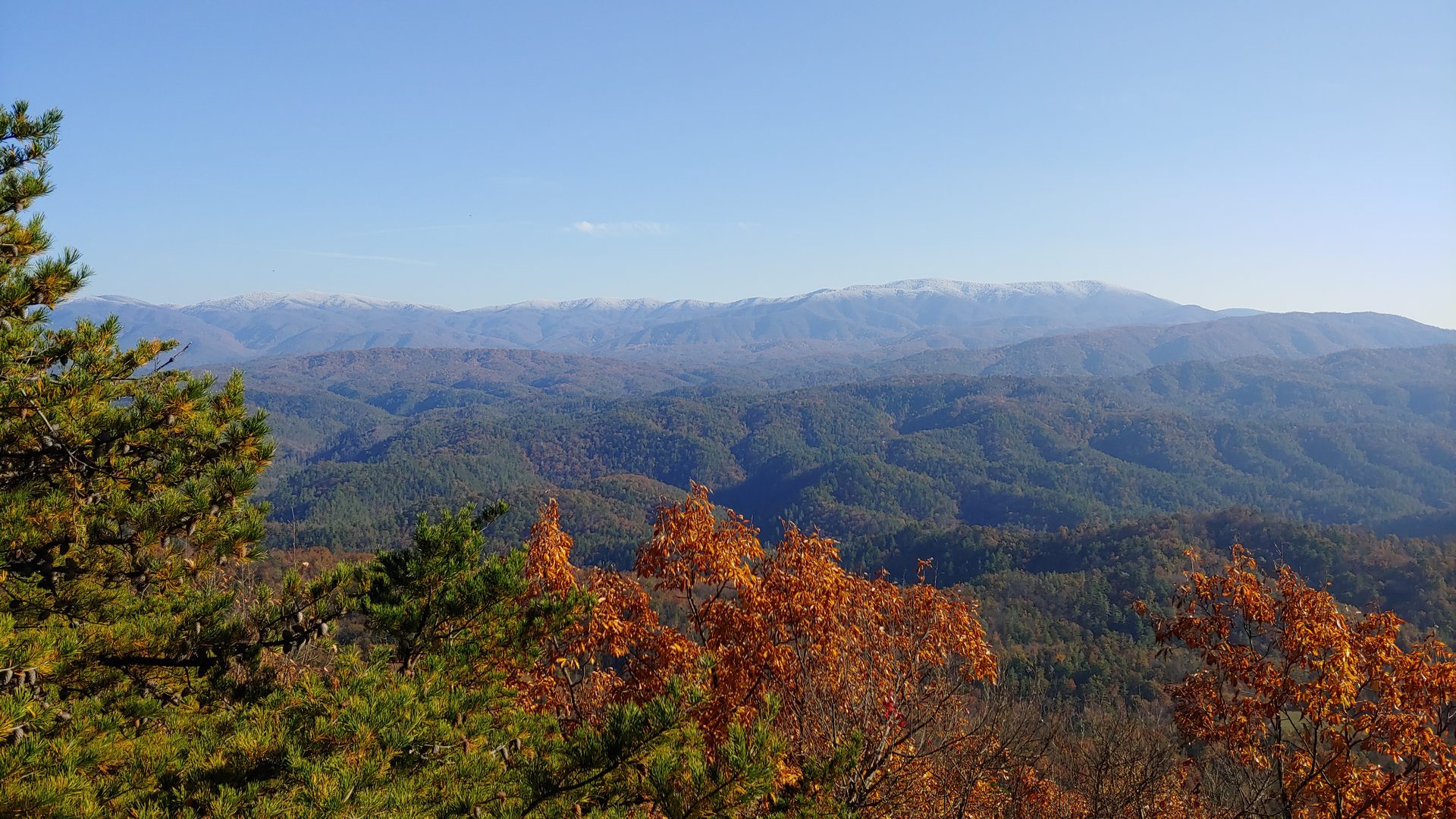
Blount County runs from the farm country and growing suburbs south of Knoxville up over Chilhowee Mountain and into the high Great Smoky Mountains, where much of its eastern half lies inside the national park. [S35] It is one of Tennessee’s oldest counties: created in 1795, a year before statehood, and named for William Blount, governor of the federal Southwest Territory. [S35][S7] Its story has an unusual number of firsts and turning points packed into one place: a college that opened its doors to Black, Cherokee and white students in the early 1800s, a Quaker village that sheltered Unionists and freedom seekers in the Civil War, the most visited valley in America’s most visited national park, a logging railroad that built a town, and an aluminum company that built a city. [S118][S130][S135][S124][S122] Today Blount has six incorporated cities, Maryville, Alcoa, Townsend, Friendsville, Louisville and Rockford, plus a corner of Vonore, a town that lies mostly in Monroe County. Places such as Walland, Eagleton Village, Wildwood and Seymour (shared with Sevier County) are unincorporated communities. [S117]
People have lived in these valleys for a very long time. In 1999 a University of Tennessee archaeologist working ahead of a highway widening in Tuckaleechee Cove, the valley where Townsend sits today, found a piece of pottery more than a thousand years old. The digs that followed turned up evidence of people living in the cove over many centuries, and the Great Smoky Mountains Heritage Center opened in Townsend in 2005 to keep and show what was found. [S140]
By the 1700s this was Cherokee land. The Overhill Cherokee towns stood along the Little Tennessee River at the county’s southern edge, with their capital at Chota nearby and a town at Chilhowee inside what became Blount County. [S35][S3] The Great War Path, the old north–south trail through the Tennessee Valley, passed close to the first settlers’ forts. [S126] (Read the bigger story in chapter 1 of our East Tennessee history.)
White settlers began arriving in the mid-1780s, on land the Cherokee had never agreed to give up. [S35] James Houston built a fortified station on Little Nine Mile Creek, south of today’s Maryville, in 1785 or 1786, one of the first permanent settlements in what became the county. [S35][S126] The years that followed were violent on both sides. In 1786 John Sevier rode out from Houston’s Station with 160 mounted men against the Cherokee towns. In 1788 the Kirk family was killed a few miles south, and soon after, Cherokee fighters killed 31 men from the fort in an apple orchard near the town of Citico, then attacked the station itself before troops drove them off. [S126] A state marker on U.S. 129 marks the site; nothing of the fort survives. [S126] (More on Sevier and the frontier in chapter 3 and our Sevier County history.)
The territorial legislature created Blount County in 1795, while Tennessee was still the federal "Territory South of the River Ohio." [S35][S7] The same act laid out the county seat and named it Maryville for Mary Grainger Blount, the governor’s wife. [S35] Her husband’s home in Knoxville, Blount Mansion, still stands and is a museum (see our Knox County guide). [S10] (See chapter 4 for how the territory became a state in 1796.)
Two small but lasting pieces of the early county are still easy to find. A few miles from Maryville, neighbors led by Revolutionary War veteran Andrew Kennedy and Henry McCulloch put up a one-room log schoolhouse, probably around 1794. [S120] And in the 1790s a colony of Quakers from New Garden, North Carolina, settled west of Maryville and founded Friendsville; their meeting was formally recognized in 1808 and is the only Friends meeting in the county that has lasted to the present. [S131][S35]
Blount County’s most famous early resident arrived as a teenager. Sam Houston, born in Virginia in 1793, came to Blount County with his widowed mother and siblings around 1807. [S35][S120] He did not take to farming or storekeeping and spent long stretches living with Cherokee friends, who adopted him and gave him the name Raven. [S120][S121] Buying gifts and supplies on credit left him in debt, so at about eighteen he took over the Kennedy log school. He charged more than the usual fee, and let families pay part of it in corn and cloth. [S120] Once his debts were paid he closed the school, and in 1813 he enlisted in the U.S. Army, the start of a career that took him to Congress, the Tennessee governor’s office and, later, the presidency of the Republic of Texas. [S120][S121] Years later he said that teaching that country school gave him more satisfaction than any office he ever held. [S120]
The Sam Houston Schoolhouse is now a state historic site. Its hewn poplar logs, window-ledge desks and low ceiling make it one of the best surviving examples of an early Tennessee field school. [S121]
In 1819 Presbyterian minister Isaac Anderson started the Southern and Western Theological Seminary in Maryville to train ministers for the frontier. [S118][S35] Anderson soon widened his aim to anyone in the region who could benefit, white, Black or Cherokee, and the seminary became known as a center of southern antislavery thought. [S118] It was chartered as Maryville College in 1842. [S118] The encyclopedia counts it among the first colleges in the country to admit African American and Native American students, and it began admitting women in 1869. [S118]
That reputation fit the county. In 1822, local Quakers and their neighbors formed an antislavery society, and for decades afterward local ministers preached against slavery from Blount County pulpits. [S129]
The Civil War closed the college from 1861 to 1866 and wrecked its downtown buildings. [S118] It reopened on a new hilltop campus in 1869, where Anderson Hall, paid for in part by the Freedmen’s Bureau and northern donors, became the first of a fine run of buildings now listed together as a National Register historic district. [S118][S129] In the late 1800s Black and white students studied together there until state segregation laws forced the college to turn Black students away in the early twentieth century. After the U.S. Supreme Court’s 1954 Brown v. Board of Education ruling, Maryville College ended segregation right away, the first college in Tennessee to do so. [S118]
When Tennessee voted on secession in 1861, Blount County voters chose the Union by 1,766 to 414, like most of East Tennessee. [S129][S13] After the Confederacy began drafting men in 1862, the Friendsville Quakers became a hidden way out. Quaker farmer William J. Hackney used a cave near his house, across the creek from the meeting house, to hide Unionists dodging the draft, conscientious objectors and people escaping slavery, with his wife cooking for the travelers. [S130] The cave room could hold about fifty people, and by the war’s end more than two thousand had passed through the Friendsville network. [S130][S35] Hackney turned down every reward. [S130] He told his story to writer John Townsend Trowbridge, whose 1863 novel Cudjo’s Cave gave the hideout the name it still carries. [S130]
The armies came through Maryville too. In December 1863, Union general William T. Sherman stopped in Maryville with about thirty thousand men on his way to relieve the siege of Knoxville, and stayed at the Pride house on Broadway. [S35][S134] In August 1864, Confederate cavalry under Joseph Wheeler attacked a small Union guard holding the courthouse. The fire they set to drive the soldiers out spread instead through the business district and many homes, while the courthouse itself came through untouched. [S129] The county’s records had been moved to a store on Main Street; as flames reached it, Polly Toole, a formerly enslaved woman, went in and carried them out. A statue of her stands in the courthouse today. [S129] (Read more in chapter 6, A Union stronghold in a Confederate state.)
Freedom brought new schools. In 1867 the Freedmen’s Normal Institute began in a log house in Maryville to train African American teachers; by 1872–74 it had a three-story brick building, and by 1879 it had sent out eighty teachers. It closed in 1901. [S132] From 1878 to 1900 the old Pride house, where Sherman had stayed, served as the Friends’ Normal Institute. [S134]
One of the institute’s founders was William Bennett Scott Sr., a free Black harness and saddle maker who had settled among the Friendsville Quakers in 1847. [S133] He learned printing during the war, started The Colored Tennessean in Nashville in 1865, the first African American newspaper in Tennessee, and in 1867 moved his press to Maryville, where for ten years he published the Maryville Republican, then the county’s only newspaper. [S133] In 1879 Maryville voters elected him mayor. [S133]
For about a century the springs at the foot of Chilhowee Mountain drew summer visitors. Daniel Foute built a road out from Maryville and a log hotel at Montvale Springs in the 1830s, and promoters called the place the "Saratoga of the South." [S127][S128] In 1853 Asa Watson of Mississippi replaced the log hotel with the larger Seven Gables Hotel. [S127] The family of poet and novelist Sidney Lanier owned the hotel from 1856 to 1863; he spent boyhood summers there, and the place shaped his novel Tiger Lilies. [S35][S127] Guests often made the climb up to Look Rock for the view. [S138] The Seven Gables burned in 1896, a later hotel burned in 1933, and the site went on to serve as a YMCA summer camp from 1948 to 2005 before being placed under a conservation easement. [S128][S35]
Cherokee hunters knew Cades Cove long before settlers arrived; archaeologists have found no sign of a major village there. [S135][S119] The first white settlers, John Oliver and his family, came in 1818, and more neighbors followed by 1821; by 1830 about 271 people lived in the cove. [S119][S135] By the late 1820s there was a small iron forge, and roads soon tied the cove’s farms to markets in Maryville and Knoxville. [S119] The cove was largely Unionist, and in the Civil War raiders from North Carolina repeatedly stripped it of food and livestock. [S119]
After the war, most of the families who stayed were related to one another, and the cove became a close-knit farm community. [S119][S35] When the national park movement came in the 1920s, many residents believed they would be allowed to stay. When it became clear that the whole cove would be taken, John W. Oliver, the first settler’s grandson, fought the state’s land condemnation through a long series of court cases beginning in 1927, and lost. [S119][S35] The park preserved many of the cove’s churches, barns, cabins and its gristmill; today it holds the widest variety of historic buildings in the park, along an 11-mile one-way loop road. [S135] (See our Cades Cove guide.)
A tannery at Walland, the Schlosser Leather Company, paid for a railroad into the foothills around the turn of the century. [S124][S35] Pennsylvania lumberman Wilson B. Townsend followed. In 1901 he and his partners chartered the Little River Lumber Company and the Little River Railroad and bought close to 100,000 acres along the Little River and its branches. [S125][S124] He built a band-saw mill in Tuckaleechee Cove, and the mill town around it took his name: Townsend. [S124][S35] By 1910 the Townsend mill was cutting about 120,000 board feet a day. [S124]
The company laid about 150 miles of track over its life and cut roughly 560 million board feet of timber. [S125] Loggers and their families lived in camps such as Tremont and Elkmont in small "setoff" houses that could be lifted onto flatcars and moved to the next job. [S125][S124] The railroad also carried tourists; its "Elkmont Special" ran from Maryville through Walland and Townsend to the summer resorts upriver. [S125] In the mid-1920s the company sold about 76,500 acres to the state for the coming national park, keeping the right to log for years afterward. The sawmill closed in 1938 and the railroad was pulled up in 1939. [S125] (See our Townsend guide.)
Making aluminum takes enormous amounts of electricity, and in 1909 the Aluminum Company of America began buying water-power rights along the Little Tennessee River. [S122][S123] It chose farmland in North Maryville for its smelter and broke ground on the South Plant in 1913. [S122][S123] The company built dams in the mountains, a workers’ town at Calderwood on the Little Tennessee, and in North Maryville a planned community with company houses and schools that, like most company towns in Tennessee then, were racially segregated. [S35][S122][S123] By 1920 the plants employed more than 3,600 people. [S123]
Maryville hoped to annex the new industrial area and its tax base. Instead, ALCOA’s medical director, newly elected to the state senate, introduced a bill to incorporate it as its own city, and the City of Alcoa was chartered on July 1, 1919, to the dismay of many Maryville residents. [S123] For decades the company and the town were nearly the same thing: ALCOA’s construction superintendent, Victor Hultquist, served as city manager into the 1950s. [S122] In the Depression the company spread the work by cutting hours rather than jobs, but a violent strike broke out in 1937, and the governor sent in the National Guard. [S122]
World War II brought the giant North Plant (1940–41), which employed about twelve thousand people and was one of the largest plants of its kind in the world. [S122] After the war the company sold its houses to workers and handed electric and water service to the city in 1955 and 1960. [S122] By 1960 ALCOA’s investment had lifted Blount from eighty-fifth among Tennessee’s ninety-five counties in total wealth into the top ten. [S35]
ALCOA also gave much of the money and land for McGhee Tyson Airport, which serves Knoxville from Blount County. [S35][S122] It carries the name of Knoxville’s old municipal field, which honored Charles McGhee Tyson, a Navy flier killed in World War I. When the city moved its airport to Blount County with New Deal help in the 1930s, boosters wanted to call it "Great Smoky Mountains Airport," but Knoxville officials kept the Tyson name because of the terms of the family’s gift of Tyson Park. That is why the airport code is still TYS. [S139]
The national park reshaped the county’s east side. Congress authorized it in 1926, local donors from schoolchildren to wealthy families raised money that Tennessee and North Carolina matched, the Rockefeller family gave $5 million, and President Franklin D. Roosevelt dedicated the park in 1940. [S35][S20] (See chapter 9.) Congress authorized the Foothills Parkway along the park’s edge on February 22, 1944. [S136] Its first long section, from Walland to Look Rock, opened on September 3, 1965, as part of the Park Service’s postwar "Mission 66" building program, and the Look Rock observation tower was finished in 1967. [S138] After decades of stops and starts, the "missing link" between Walland and Wears Valley opened in late 2018, creating a 33-mile ridgetop drive from Chilhowee to Wears Valley. [S137][S138] The full 72-mile parkway is still unfinished, the oldest uncompleted highway project in Tennessee. [S136]
| Year | What happened |
|---|---|
| c. 1000 years ago and earlier | People living in Tuckaleechee Cove (found by the 1999 Townsend digs) [S140] |
| 1700s | Overhill Cherokee towns on the Little Tennessee, including Chilhowee [S35][S3] |
| 1785–86 | James Houston builds Houston’s Station [S126][S35] |
| 1788 | Kirk family killed; Cherokee attack on Houston’s Station [S126] |
| c. 1794 | Kennedy–McCulloch log schoolhouse built [S120] |
| 1795 | Blount County created; Maryville laid out [S35] |
| 1790s | Quakers from North Carolina settle Friendsville [S131] |
| c. 1807 | Houston family moves to Blount County [S120] |
| 1818–21 | First settlers in Cades Cove [S119][S135] |
| 1819 | Southern and Western Theological Seminary founded [S118] |
| 1822 | Antislavery society formed in Blount County [S129] |
| 1830s | Montvale Springs resort opens [S127][S128] |
| 1842 | Maryville College chartered [S118] |
| 1861 | County votes 1,766 to 414 to stay in the Union [S129] |
| 1862–65 | Friendsville Quakers hide Unionists and freedom seekers at "Cudjo’s Cave" [S130] |
| 1863 | Sherman’s army passes through Maryville, December [S35][S134] |
| 1864 | Confederate raid and fire in Maryville, August [S129] |
| 1867 | Freedmen’s Normal Institute begins; Scott brings his press to Maryville [S132][S133] |
| 1879 | William B. Scott Sr. elected mayor of Maryville [S133] |
| 1901 | Little River Lumber Company and Little River Railroad chartered [S125][S35] |
| 1906 | Blount County Courthouse built [S35] |
| 1913 | ALCOA breaks ground on its South Plant [S123][S122] |
| 1919 | City of Alcoa chartered, July 1 [S123] |
| 1927 | Cades Cove residents begin their court fight against the park [S35][S119] |
| 1933 | Last Montvale Springs hotel burns [S35][S128] |
| 1937 | Alcoa strike; National Guard sent in [S122] |
| 1938–39 | Townsend sawmill closes; Little River Railroad abandoned [S125] |
| 1940 | Great Smoky Mountains National Park dedicated [S20] |
| 1944 | Congress authorizes the Foothills Parkway, Feb. 22 [S136] |
| 1954 | Maryville College ends segregation after Brown [S118] |
| 1965 | Foothills Parkway opens from Walland to Look Rock, Sept. 3 [S138] |
| 1967 | Look Rock observation tower finished [S138] |
| 2005 | Great Smoky Mountains Heritage Center opens in Townsend [S140] |
| 2018 | Foothills Parkway "missing link" opens [S137][S138] |
Start in downtown Maryville at the 1906 Blount County Courthouse, where the Polly Toole statue stands, then walk Broadway past the state markers for Montvale Springs, the Pride house, William B. Scott Sr. and the Freedmen’s Institute. [S129][S127][S134][S133][S132] Stroll the Maryville College campus, then drive out to the Sam Houston Schoolhouse; check its hours first, since it closes on Sundays and Mondays and for part of the winter. [S121] Head west to Friendsville to see the Quaker meeting house and the Underground Railroad marker. [S130][S131] In the afternoon, drive U.S. 321 through Walland to Townsend for the Little River Railroad and Lumber Company Museum and the Great Smoky Mountains Heritage Center, then go on into Cades Cove for the loop road. Look for its churches and Cable Mill, and note that the loop is closed to cars on Wednesdays from May through September. [S135][S140] End the day on the Foothills Parkway at Look Rock, where Montvale’s hotel guests once climbed for the view. [S138] Next door, our Sevier County history picks up the story over the mountain in Wears Valley, Pigeon Forge and Gatlinburg.
Visit: Blount County Courthouse, Maryville · Maryville College Historic District · Sam Houston Schoolhouse State Historic Site · Friendsville Friends Meeting · Little River Railroad and Lumber Company Museum, Townsend · Great Smoky Mountains Heritage Center, Townsend · Cades Cove, Great Smoky Mountains National Park · Look Rock Tower, Foothills Parkway
Every bracketed number on this page links here. Written by My East TN in our own words and checked against each source on 2026-10-28 (ET). Where sources disagree (for example, whether Houston's Station dates to 1785 or 1786, whether the first Cades Cove settlers came in 1818 or the early 1820s, whether Daniel Foute's first Montvale hotel went up in 1832 or 1837, whether the town of Alcoa dates from 1914 or its 1919 city charter, and whether the national park was established in 1934 or 1935), we give the range or leave the exact year out. We don’t republish encyclopedia or museum text — follow the links for the full articles.
Images: My East TN photos and Studio illustrations only. Corrections: [email protected].