Townsend cabins
The "peaceful side of the Smokies" is about 15 minutes to Cades Cove and an easy run to the parkway.
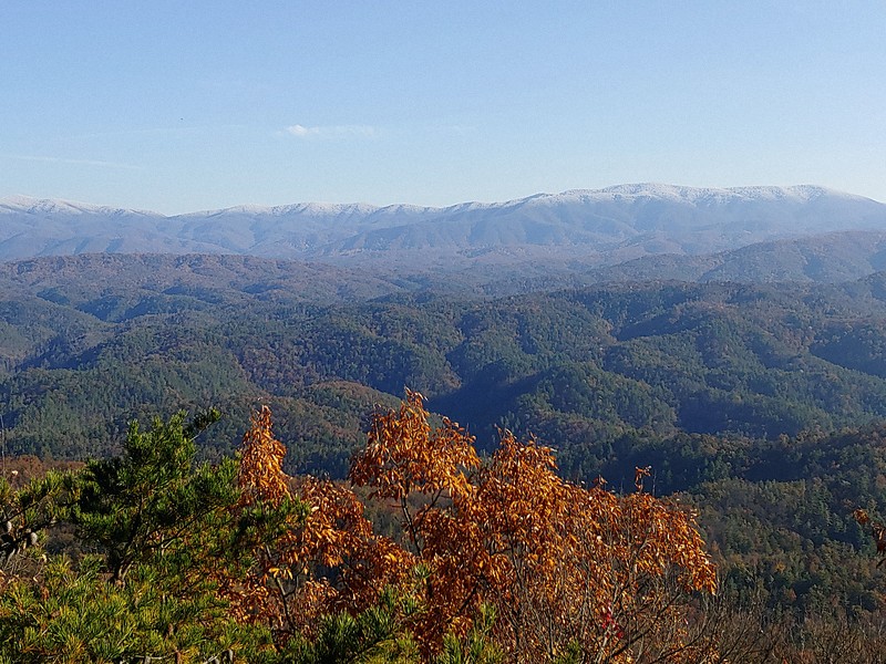
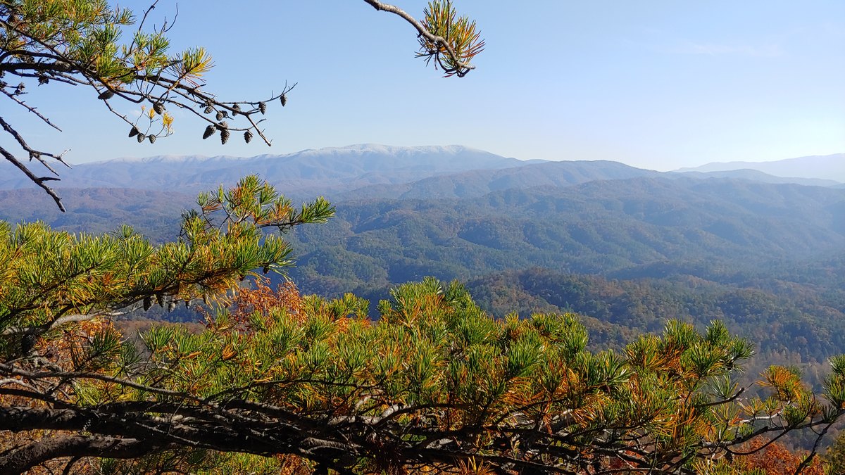
See cabins (placeholder) →Photo: My East TN — first snow on the high Smokies over autumn oaks, Look Rock. Buy this print →
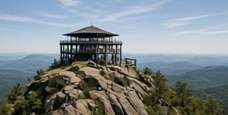
A Mission 66 lookout tower on the quiet side of the Smokies. A short paved walk gets you a wide view of the high peaks, the Cades Cove ridges, and on clear days the Cumberland Plateau, without the Cades Cove traffic.
Facts checked Oct 27, 2026 via NPS: Look Rock Tower Trail and NPS: Drive Foothills Parkway. Roads and facilities can change, so check NPS before you go.
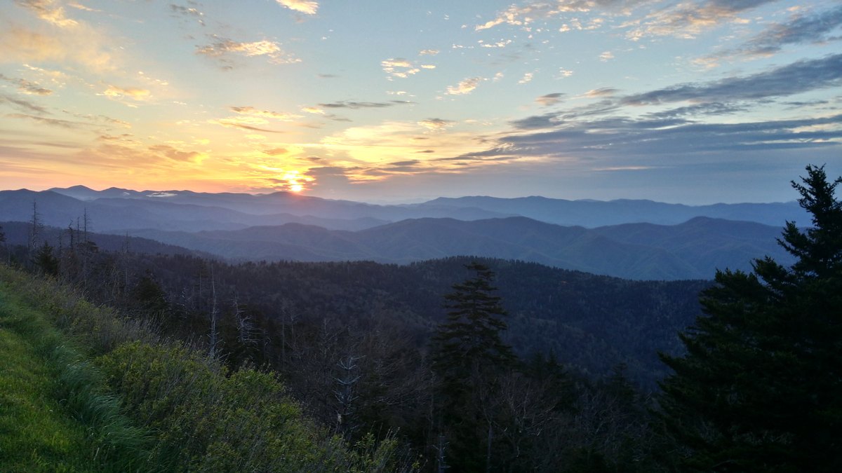
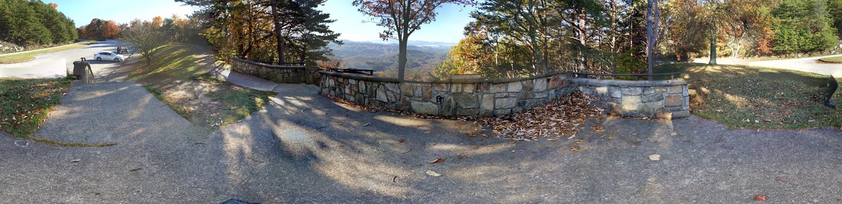
Photos: My East TN. Map: free OpenStreetMap embed; pin is approximate [verify].
Most first-timers spend hours in the Cades Cove line and never see the park from above. Look Rock sits on Chilhowee Mountain, the long ridge between the Little Tennessee River and Tuckaleechee Cove, in the national park. It's a short walk to an observation tower, and the view runs across the valleys to Thunderhead and the high Smokies on one side and toward Maryville and the Cumberland Plateau on the other.
It's free to look (you need a parking tag if you stay more than 15 minutes), there's almost no commercial development up here, and it pairs well with a morning in Townsend or a drive on the Tail of the Dragon side.
Check the NPS Look Rock webcam before you drive up. Haze and snow on the peaks are easy to read from the camera, and the view changes a lot from day to day.
Long before the parkway, guests at the Montvale Springs Hotel at the foot of Chilhowee Mountain hiked about three miles up primitive trails to the Look Rock vantage. The hotel burned in 1933. Congress authorized the Foothills Parkway in 1944, and under the Park Service's Mission 66 program the Walland–Look Rock section opened on September 3, 1965. The campground and picnic area opened the next day. Smokies Life describes the parkway as a kind of "safety valve" to draw visitors away from the busiest parts of the park.
| 1832–1933 | Montvale Springs Hotel era. Guests hike to the Look Rock vantage. |
| 1944 | Congress authorizes the Foothills Parkway. |
| Sep 3, 1965 | Walland–Look Rock section opens (Mission 66). |
| 1966–67 | Today's concrete Look Rock Tower is built, replacing an earlier tower. It is the last of the park's three "Park Service Modern" towers. |
| 2013 | Picnic area and campground close for budget and water-system work. |
| 2018 | The Wears Valley–Walland section opens, creating a long ridgetop drive. |
| 2019 / 2022 | Picnic area reopens (2019), then the campground (2022). |
The tower is about 78 feet tall, with a switchback ramp instead of Clingmans Dome's spiral. The old fire-watch cab now holds a webcam and monitoring gear. About 550 feet from the tower, Look Rock is also one of the park's main air-quality stations, which helps track the haze that gives the Smokies their name and also hides the view on some summer days.
Sources: Smokies Life (official park partner) · NPS National Register nomination · NPS air quality. Checked Oct 27, 2026.
Look Rock is on Foothills Parkway West, the stretch between Walland (US-321) and Chilhowee Lake (US-129). NPS mileposts start at the Chilhowee end, and the tower trail parking and lower overlook are at about mile 7.1.
Take US-321 toward Townsend and join Foothills Parkway West at Walland. Drive southwest along the ridge about 9.5 miles to the Look Rock parking area.
NPS: "take US-321 to the Foothills Parkway and follow this scenic road to the Look Rock tower parking area." Easy to combine with a Cades Cove morning.
Coming from the Tail of the Dragon / Tellico side, enter at US-129 by Chilhowee Lake. Look Rock is about 7 miles in.
There are no gas stations, food, or trash cans on the parkway. Fill up in Maryville or Townsend, and pack out what you bring.
Checked Oct 27, 2026: NPS: Drive Foothills Parkway · Recreation.gov: Look Rock Campground. [Editor: NPS trail page lists the trailhead "between mile markers 14 and 15" while the drive page says mile 7.1. Confirm on site before publish.]
The Look Rock Tower Trail is about 0.8 miles round trip on pavement with mild to moderate climbs. NPS notes that it's "paved but steep" in places, and the ramp to the top of the tower is steep too.
The trail starts just north of the parking area. Watch for traffic when you cross the parkway.
It's a steady uphill through oak and pine woods. Take it slow, since there are no benches to speak of.
The ramp circles up to the open viewing deck. You'll see the high Smokies to the south and east, and Maryville and the Plateau to the northwest.
A set of stairs from the lot leads down to a lower overlook. You get a big view with almost no hiking, but it isn't wheelchair accessible.
Pets aren't allowed on the trail (they're fine at the picnic area and along roads). There are no restrooms at the lot. The nearest are at Look Rock Picnic Area, which is seasonal.
Drive the whole parkway. The Walland–Chilhowee section has 16 parking areas, 14 of them overlooks. The southern overlooks face southeast toward the mountains around Cades Cove, which is the sunrise spot. The northern stretch looks down on the farms of Millers Cove.
Picnic or camp (seasonal). Look Rock Picnic Area and Look Rock Campground are about half a mile past the tower lot and open seasonally. The campground books through Recreation.gov. Both are closed for the 2026 season, so watch NPS for 2027 dates.
Make it a loop. Pair Look Rock with Townsend & Cades Cove in the morning, or follow US-129 south past Chilhowee Lake toward the Dragon and Tellico.
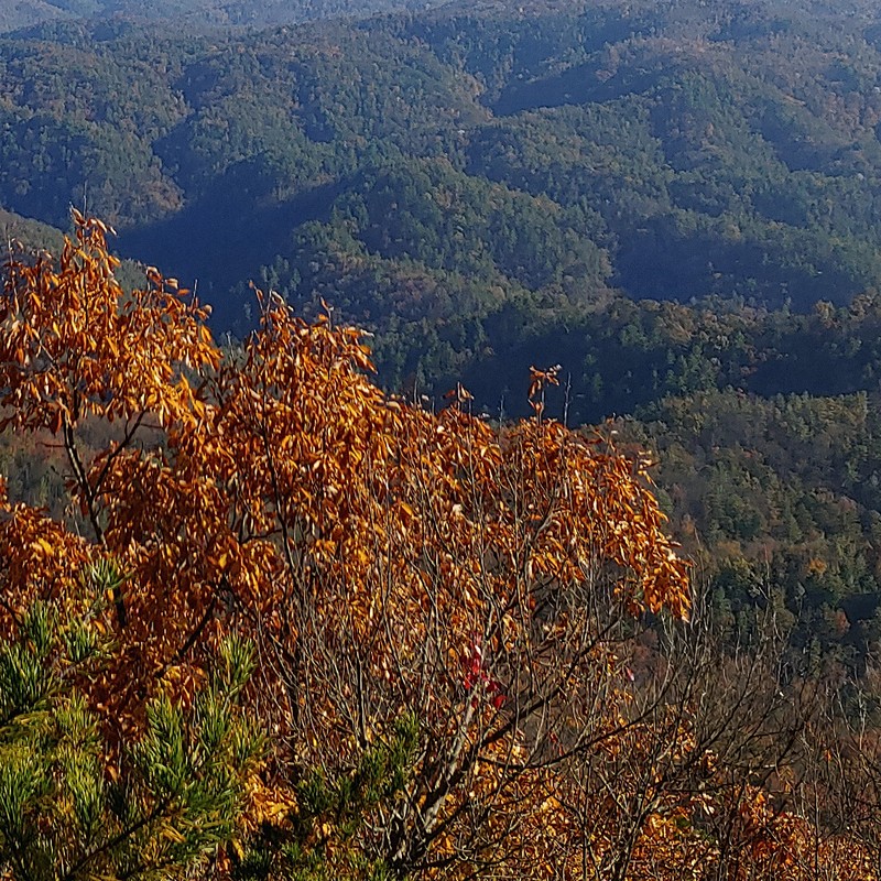
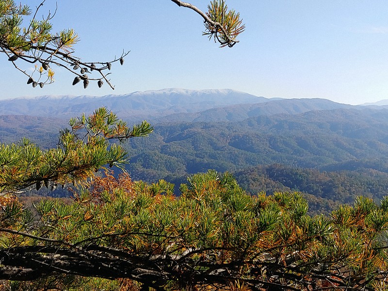
Overlook on the Foothills Parkway / Look Rock area. Photo: My East TN.
Late fall / early winter: the best time for the "white peaks over color" look. Snow can dust Thunderhead and the high ridges while the Chilhowee oaks still hold their leaves. NPS reminds visitors that clear skies in the valleys don't mean the same weather up high.
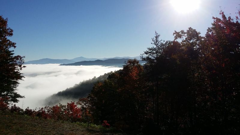
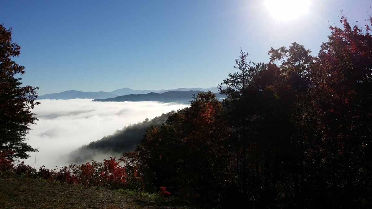
Winter mornings: valley fog and temperature inversions fill Happy Valley and Tuckaleechee Cove below you.
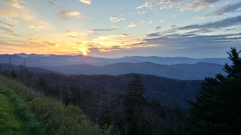
Sunrise: use the southeast-facing overlooks on the southern part of the parkway. Summer: haze is common, so go early or right after a front clears the air.
[Reserved: 3–5 first-person tips from the photographer who took the photos on this page. Ideas: where #13 was shot (tower deck, lower overlook, or a pull-off) · best time of day · favorite route up from Maryville · ice or closure lessons · a Townsend/Maryville stop worth naming.]
Love the hero shot? It's available as a print. Buy this print →
Two easy bases: quiet cabins in Townsend and Walland, or hotels in Maryville/Alcoa near the airport. Where to stay
The "peaceful side of the Smokies" is about 15 minutes to Cades Cove and an easy run to the parkway.
See cabins (placeholder) →
Farm-country stays right at the parkway's Walland entrance.
See stays (placeholder) →
A practical base near TYS airport for a pre-dawn sunrise run.
See hotels (placeholder) →There's no food on the parkway, so bring snacks and water. Good stops are in Townsend (breakfast, BBQ) and Maryville (local and chain dining on US-321). [Editor: add 3 named picks, verified open, no hours or prices.]
It's short, about 0.8 miles round trip on pavement, but it has some steep sections and a steep ramp up the tower. Most people who walk regularly can do it slowly. NPS trail details.
Not on the tower trail. Pets are allowed at the picnic area and along roads on a leash.
The tower is generally open year-round unless the parkway is closed for weather. The picnic area and campground are seasonal. Check road closures first.
Yes, if you park anywhere in Great Smoky Mountains National Park for more than 15 minutes. See NPS fees & passes for current options.
Not at the tower lot. The nearest are at Look Rock Picnic Area, which is open seasonally.
From Walland (US-321) it's about 9.5 parkway miles. Townsend and Maryville are both short drives to the Walland entrance. [Verify drive times in Google Maps before publish.]
Part of Blount County history →
From our shop · Fine Art America
Prints help keep the guides free — thank you for supporting My East Tennessee.
My East Tennessee shop → · All East TN prints → · Arrow River designs → ·