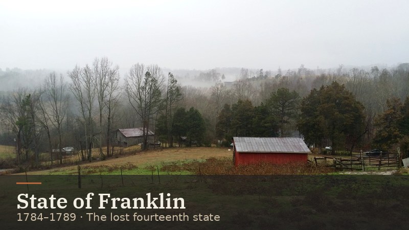
The Lost State of Franklin (1784–1789)
How East Tennessee settlers tried to form their own state — and what Franklin left behind in Sevier County and beyond.
Read the story →East Tennessee History
Mountains, rivers, and the people who shaped them
East Tennessee is a land of hard edges and big stories. It runs from the Cumberland Plateau to the crest of the Smokies. People here wrote one of the first frontier governments, tried to form their own state, voted for the Union while the rest of Tennessee left it, and later helped build the atomic age. This page is your starting point. Each chapter is short, sourced, and links on to the county pages and the places you can still visit.
| When | What happened |
|---|---|
| c. A.D. 900–1600 | Mississippian towns with earthen mounds rise along the Tennessee, Little Tennessee, and Clinch rivers [S2] |
| 1700s | The Overhill Cherokee towns (Chota, Tanasi, Great Tellico, and others) are centers of Cherokee life [S3] |
| 1756–1760 | The British build Fort Loudoun among the Overhill towns. Cherokee forces besiege it, and it surrenders in 1760 [S4] |
| 1772 | Watauga settlers form the Watauga Association [S5] |
| 1784–1789 | The State of Franklin rises and fades [S6] |
| 1786 / 1791 | James White builds his fort. It becomes Knoxville, capital of the Southwest Territory [S8] |
| June 1, 1796 | Tennessee becomes the 16th state [S7] |
| 1838–1839 | The Cherokee are forcibly removed on the Trail of Tears [S12] |
| 1861 | East Tennessee votes about 2-to-1 to stay in the Union, and Unionists meet in Greeneville [S13][S14] |
| Nov 29, 1863 | The Confederate assault on Fort Sanders fails, and Knoxville stays in Union hands [S8][S13] |
| 1880 | Rugby is founded on the Cumberland Plateau [S19] |
| 1891–1892 | The Coal Creek War against convict leasing [S17][S18] |
| 1925 | The Scopes Trial in Dayton [S26] |
| 1927 | The Bristol Sessions, the "big bang" of country music [S28] |
| 1933 | TVA is created, and Norris Dam becomes its first project [S21][S22] |
| Sept 2, 1940 | Great Smoky Mountains National Park is dedicated [S20] |
| 1942–1945 | Oak Ridge (the Clinton Engineer Works) is built for the Manhattan Project [S23] |
| Aug 26, 1956 | The "Clinton 12" desegregate Clinton High School [S25] |
| 1982 | The Knoxville World’s Fair [S29] |
| 1986 | Dollywood opens in Pigeon Forge [S30] |
Start here
How East Tennessee settlers tried to form their own state — and what Franklin left behind in Sevier County and beyond.
Read the story →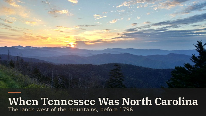
From North Carolina’s overmountain counties to the Southwest Territory and statehood on June 1, 1796.
Read the story →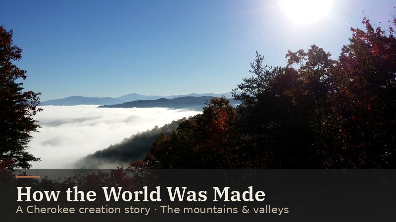
The Cherokee story of the Water-beetle who brought up the earth, as recorded from Cherokee storytellers in the late 1880s.
Read the story →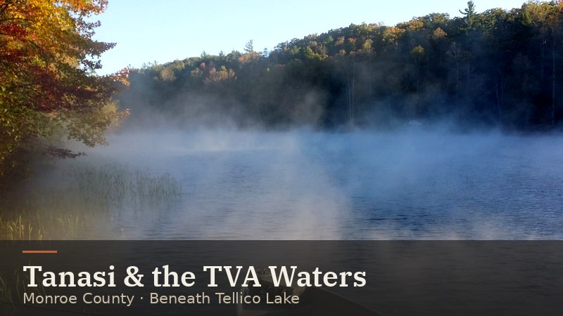
Tanasi (also written Tenasi), Overhill Cherokee town on the Little Tennessee, now beneath TVA’s Tellico Lake.
Read the story →Long before any fort or courthouse, farming towns lined East Tennessee’s river bottoms. From about A.D. 900 to 1600, Mississippian peoples grew corn, beans, and squash. They built flat-topped earthen mounds with public buildings on top, and they made shell-tempered pottery. Archaeologists name the region’s phases Martin Farm, Hiwassee Island, and Dallas. Historians see the Cherokee as heirs of these cultures. [S2]
By the 1700s the Overhill Cherokee towns lined the lower Little Tennessee and Hiwassee rivers: Chilhowee, Tallassee, Citico, Chota, Tanasi, Toqua, Tomotley, Tuskeegee, Mialoquo, Great Tellico, and others. Each town had an eight-sided council house that could reach sixty feet across. Chota became the "mother town" by the mid-1700s, and before it, Tanasi held that role. Famous leaders lived here, including the diplomat Attakullakulla, the war leader Oconastota, and Dragging Canoe, who resisted American expansion during the Revolution. [S3]
Sequoyah, who created the Cherokee writing system, was born at Tuskegee on the Little Tennessee in today’s Monroe County. Cherokee leaders adopted his syllabary in 1821, and within five years thousands of Cherokee could read and write. [S11]
Most Overhill town sites were flooded by Tellico Reservoir in the late 1970s, after archaeologists studied them. A memorial marks Chota. [S3]
Visit: Sequoyah Birthplace Museum (Vonore) ↗ · Fort Loudoun State Historic Park ↗ · Museum of the Cherokee People (Cherokee, NC) ↗
Our deeper read
In 1756–57, during the Seven Years’ War, the British built Fort Loudoun on the Little Tennessee River near Tomotley and Tuskeegee. They meant it to bind the Overhill Cherokee to Britain against France. As relations broke down, the Cherokee besieged the fort in 1760. On August 9, 1760, the starving garrison marched out with women and children. The next day Cherokee warriors attacked the column near Tellico Plains. A replica of the fort stands today at the state historic site. [S4]
By 1772 about seventy farms sat along the Watauga River, outside any colony’s control, on land the settlers had leased from the Cherokee. They formed the Watauga Association, a five-man court run under Virginia law. The Tennessee Encyclopedia calls it the first white government in Tennessee. [S5]
After the Revolution, westerners frustrated with distant North Carolina went further. In 1784 they declared the State of Franklin, elected Revolutionary War hero John Sevier as governor, and governed from Greeneville. Franklin collected some taxes in goods instead of money. Feuds between Sevier and his rival John Tipton, plus North Carolina’s offers of pardons, wore the movement down. By early 1789 it was all but over. [S6]
Visit: Sycamore Shoals State Historic Park ↗ · Marble Springs State Historic Site ↗
Our deeper read
In 1790 North Carolina’s western lands became the Territory South of the River Ohio, better known as the Southwest Territory. Its first capital was Rocky Mount, near the Watauga. Governor William Blount moved the capital to Knoxville in 1792. [S7]
Knoxville began as James White’s fort, built in 1786. In 1791 Blount named the town for Secretary of War Henry Knox. Lots were laid out with street names borrowed from Philadelphia and Baltimore, and land was set aside for Blount College, which grew into the University of Tennessee. That year George Roulstone started the Knoxville Gazette, Tennessee’s first newspaper. [S8][S9]
Blount’s frame house had so many glass windows that, as Native Americans reportedly put it, it was "the House With Many Glass Eyes." It survives as Blount Mansion, Knoxville’s only National Historic Landmark. [S10]
A census counted 77,262 people in late 1795, well over the 60,000 needed for statehood. Delegates met in Knoxville in January 1796 to write a constitution. Congress admitted Tennessee as the 16th state on June 1, 1796, the first state carved from a federal territory. Sevier became its first governor. [S7]
Visit: Blount Mansion ↗ · James White’s Fort (both downtown Knoxville) ↗
Pressure for Cherokee land kept growing. After Georgia blocked the Cherokee government from meeting, the Cherokee moved their capital to Red Clay, just over the Tennessee line. A minority signed the Treaty of New Echota in 1835, and the U.S. Senate ratified it by a single vote. Most Cherokee, led by John Ross, refused to accept it. In May 1838 federal troops began rounding up families into camps. Groups set out from the area in 1838–39. Of the roughly 14,000 people who began the journey west, more than 4,000 are believed to have died. [S12]
Visit: Red Clay State Historic Park ↗ · Cherokee Removal Memorial at Blythe Ferry ↗ · Trail of Tears National Historic Trail ↗
In 1861 East Tennessee broke from the rest of the state. In February, Tennesseans rejected a secession convention, and East Tennessee opposed it overwhelmingly. In the June 8, 1861 referendum the state voted to secede, but East Tennessee voted about 33,000 to 14,000 to stay in the Union. [S13]
On June 17, 1861, delegates from every East Tennessee county except Rhea met in Greeneville. Their leaders included Andrew Johnson, William G. "Parson" Brownlow, Horace Maynard, and T. A. R. Nelson. They asked the legislature to let East Tennessee form a separate state. The legislature refused, and Confederate troops under Gen. Felix Zollicoffer occupied the region. [S13][S14]
On the night of November 8, 1861, Unionists burned railroad bridges across the region to cut Confederate supply lines. At Lick Creek in Greene County, potter Alex Haun and his neighbors burned the bridge. Haun and three others were later hanged after a court-martial in Knoxville. [S15]
In September 1863 Union Gen. Ambrose Burnside entered Knoxville to cheering crowds. On November 29, 1863, Confederate Gen. James Longstreet attacked Fort Sanders. The assault lasted about twenty minutes, Confederate casualties topped 800, and Knoxville stayed in Union hands for the rest of the war. [S8][S13] About 31,000 Tennesseans served in the Union army, more than all the other Confederate states combined. [S13]
Andrew Johnson, a Greeneville tailor, became military governor of Tennessee, then Lincoln’s vice president. In 1865 he became the 17th president. He is buried in Greeneville. [S16]
Visit: Andrew Johnson National Historic Site (Greeneville) ↗ · Tennessee Civil War National Heritage Area ↗
Railroads changed the region after the war. By 1896 Knoxville claimed to be the South’s third-largest wholesale center, behind only Atlanta and New Orleans. [S8] On the Cumberland Plateau, the Cincinnati Southern Railroad opened in 1880 and helped mining and logging towns such as Sunbright and Oakdale grow. [S31]
Rugby. In 1880 the English author Thomas Hughes (Tom Brown’s School Days) lent his name to a planned community in northern Morgan County. It was officially christened on October 5, 1880. Typhoid, fires, and poor management hurt the colony. In 1966 a restoration group led by 17-year-old Brian Stagg began saving it, and Historic Rugby welcomes visitors today. [S19]
The Coal Creek War. Tennessee leased state prisoners to coal companies, which undercut free miners’ wages. On July 14, 1891, miners at Briceville (Anderson County) took over the stockade and shipped the convicts to Knoxville. On October 31, 1891 they freed the convicts and burned the stockade, and they raided Oliver Springs days later. The state passed laws in 1893 to build a new penitentiary and end leasing when the contracts ran out in the mid-1890s. The result was Brushy Mountain prison in Morgan County. [S17][S18][S31]
Visit: Historic Rugby ↗ · Coal Creek Watershed Foundation (Coal Creek history) ↗ · Frozen Head State Park ↗
The Scopes Trial (1925). Tennessee’s Butler Act banned teaching that humans descended from "a lower order of animals." The ACLU offered to back a test case, Dayton’s civic leaders volunteered their town, and teacher John T. Scopes went on trial in July 1925. The trial’s famous moment came when Clarence Darrow called William Jennings Bryan to the stand as an expert on the Bible. That ninety-minute exchange came on July 20. The next day the jury took less than ten minutes to convict, and Judge John Raulston fined Scopes the $100 minimum. [S26] For about eight days Dayton swelled from roughly 1,800 people to about 5,000. Bryan died in Dayton five days after the trial, and Bryan College opened in his honor in 1930. [S27]
The verdict didn’t stand. In January 1927 the Tennessee Supreme Court upheld the Butler Act but threw out Scopes’s conviction, because the state constitution required a jury, not a judge, to set any fine over $50. The Butler Act stayed on the books until 1967. The 1892 Rhea County Courthouse is still in use and is a National Historic Landmark. [S26][S27]
The Bristol Sessions (1927). In July 1927, producer Ralph Peer recorded the Carter Family and Jimmie Rodgers in a makeshift studio in Bristol. The sessions are often called the "big bang" of country music. [S28]
Visit: Rhea Heritage & Scopes Trial Museum (Dayton) ↗ · Birthplace of Country Music Museum (Bristol) ↗
TVA. President Roosevelt signed the TVA Act on May 18, 1933. In Union County, near the Norris site, there had been no electric utilities as late as 1926. TVA’s first project, Norris Dam on the Clinch River in Anderson County (1933–36), was named for Nebraska Senator George Norris. Its clean modern design by architect Roland Wank set the style for TVA. Inside, TVA projects carry the words "Built for the People of the United States." [S21][S22] By 1946, TVA had moved an estimated 72,000 people off land it acquired. [S21]
Great Smoky Mountains National Park. The Smokies had to be bought, tract by tract, from about 6,000 landowners, including big timber companies. Knoxville boosters started pushing for a park in 1923. Schoolchildren gave pennies, both states issued bonds, and John D. Rockefeller Jr. gave the final $5 million in memory of his mother. More than 4,000 residents had to leave. Places like Cades Cove keep their buildings today. Roosevelt dedicated the park on September 2, 1940. [S20][S35]
Visit: Norris Dam area · Museum of Appalachia ↗ · GSMNP history and culture programs ↗ · Cades Cove
Our deeper read
In September 1942 Gen. Leslie Groves chose a quiet stretch of Anderson and Roane counties for the Manhattan Project. About 1,000 families lived in communities such as Wheat, Elza, Scarboro, and Robertsville, and they were told to leave, sometimes by notices nailed to fence posts. The site was named the Clinton Engineer Works. Three giant plants were built there: X-10 (the Graphite Reactor), Y-12, and K-25. By summer 1945 the town had about 75,000 people, and uranium enriched here went into the bomb dropped on Hiroshima. The gates opened to the public in 1949. [S23]
Visit: Manhattan Project National Historical Park, Oak Ridge ↗ · American Museum of Science & Energy ↗
On August 26, 1956, twelve Black students walked down Foley Hill from Green McAdoo School to Clinton High School. They were the first to desegregate a state-supported high school in Tennessee or any Southern state. Mobs followed, and Gov. Frank Clement sent in the National Guard. In December, Rev. Paul Turner escorted the students to school and was beaten by a mob afterward. On May 17, 1957, Bobby Cain graduated. He was the first Black graduate of a desegregated public high school in the South. The school was bombed in 1958 and later rebuilt. [S25]
1982 World’s Fair. The Knoxville International Energy Exposition ran from May to October 1982 on 67 acres west of downtown. Its theme was "Energy Turns the World." President Reagan attended opening day, and the fair drew about 11 million visitors. [S29]
Dollywood. The park’s train goes back to 1961, when the Robbins family rebuilt an abandoned logging railroad and locomotive as Rebel Railroad. It became Goldrush Junction in 1970 and Silver Dollar City in 1977. Dolly Parton partnered with the Herschends in 1985, and Dollywood opened in 1986. The old train became the Dollywood Express. [S30]
A county on the Plateau. The legislature created Morgan County in 1817, mostly from Roane County land. It was named for Revolutionary War Gen. Daniel Morgan, and its first seat, Montgomery, was named for Maj. Lemuel P. Montgomery, a Knoxvillian killed at Horseshoe Bend in 1814. The first permanent settlers, Samuel and Martin Hall, came after the Third Tellico Treaty opened the land in 1805. Rugged ground and the unnavigable Obed and Emory rivers kept farms small. Coal was first dug here in 1819. [S31]
A German town in the mountains. New York businessman George F. Gerding, born in Germany in 1800, organized a colonization company for Swiss, German, and French immigrants. The state historical marker at the courthouse says he founded Wartburg in 1844 and gave land for the town square, a church, and a cemetery. [S36] The first fifty settlers arrived from Mainz in 1845, and two more groups followed in 1846. They planted vineyards and orchards, made cigars and furniture, and briefly ran the Wartburg Piano Company. The newcomers included an architect, a university-trained musician, and eight physicians. Land-price fights, church disputes between Reformed and Lutheran congregations, and the Civil War wore the colony down. By 1870 only 57 German-born and 41 Swiss-born residents remained. [S31]
War on the Plateau. Morgan County voted to stay in the Union in 1861, but neighbors split. Gerding himself sided with the Confederacy, while Lutheran pastor John Wilken fled as a Unionist. On February 2, 1862, Confederate cavalry clashed with the Union Home Guard near Wartburg, and five Home Guard men were killed. Foraging by both armies stripped the farms, and county government collapsed. After the war the county seat moved from Montgomery to Wartburg. Today’s courthouse dates to 1904. [S37][S31]
Rails, resorts, and a prison. The Cincinnati Southern Railroad (1880) built up Sunbright, Lancing, and Oakdale, and it carried summer visitors to resorts at Deer Lodge. In April 1893 the state funded Brushy Mountain penitentiary on 9,000 acres, where prisoners mined coal for the state. In the New Deal years a Civilian Conservation Corps camp worked in the county. Frozen Head State Park, Catoosa, the Obed, and Big South Fork carry that outdoor story forward. [S31]
Visit: Morgan County Courthouse markers (Wartburg) ↗ · Historic Rugby ↗ · Frozen Head State Park ↗ · Obed Wild & Scenic River ↗
Each county gets its own deep page next. These teasers link to the county pages.
Sources: every bracketed number links to the source list at the bottom of this page. Facts were checked against the cited source on Oct 28, 2026 (ET).
Every bracketed number on this page links here. Facts were checked against each source on Oct 28, 2026 (ET). We summarize in our own words and link out; we don’t republish encyclopedia or museum text.
Images: My East TN photos and Studio illustrations (site-only). Corrections: [email protected].